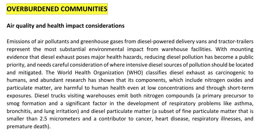
Click on image to download a copy of the September 7, 2022 New Jersey State Planning Commission - Warehouse Siting Guidelines
The September 7, 2022 New Jersey State Planning Commission - Warehouse Siting Guidelines (NJSP-WSG Report) provides infomation on where warehouses make sense, and where warehouse should not be built. The graphic at the top of this page, "Overburdened Coumminities - Air quality and health impact considerations", is a snapshot of part of the NJSP-WSG Report.
The report also specifies that warehouses over 150,000 square feet should not be built in or next to overburdened communities. The New Jersey Department Of Environmental Protection has designated the area of the Flats of Phillipsburg as being an overburdened community. All of the four currently approved site plans for warehouses on the Peron Howard Street property are over twice the square footage of 150,000 square feet. Hence, no warehouse over 150,000 square feet should be approved for this property. Additionally, since there are currently trucks travelling through the area of the Flats for McWayne Ductile, and other pollution from McWayne Ductile, no warehouse should be built on the Peron Howard Street property.
Evidence that the Flats is an overburdened area
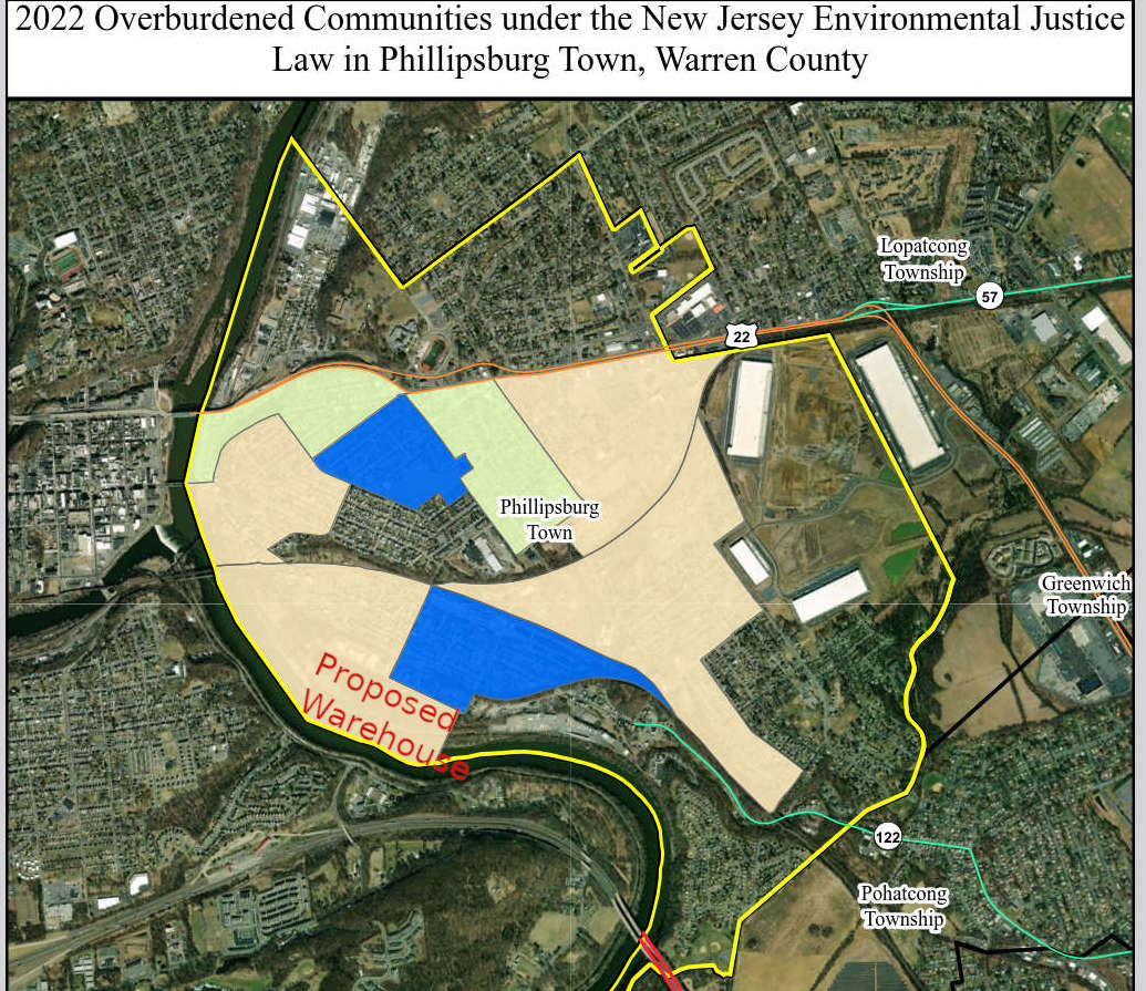
The New Jersey Department of Environmental Progection has classified the area of the Flats of Phillipsburg as an overburdened community. Below you can see maps showing the sections of town that are classified as overburdened communities.
|
The map below shows a snapshot of a map from the NJ Department of Environmenal Protection. The area shaded in blue has a classification of being overburdened in low-income and minority. The area shaded in yellowish-tan is classified as being overburdened in low-income. Click on the image to be taken to the page that has the actual map from which the snapshot was taken. |
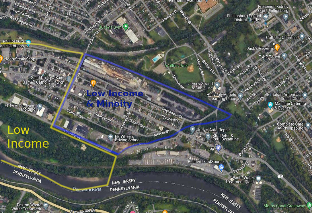
The graphic below is a epresentation of the NJ Department Environmental Protection's Phillipsburg map which shows overburdened areas. Instead of being colored in solid, the areas are deliniated by lines in order to make the map more easily readible. The blue line encircles an area of the Flats that is defined as being overburdened in terms of "Low Income and Minority" and the area encircled with yellow is overburdened in temrs of "Low Income". |
 |
 |
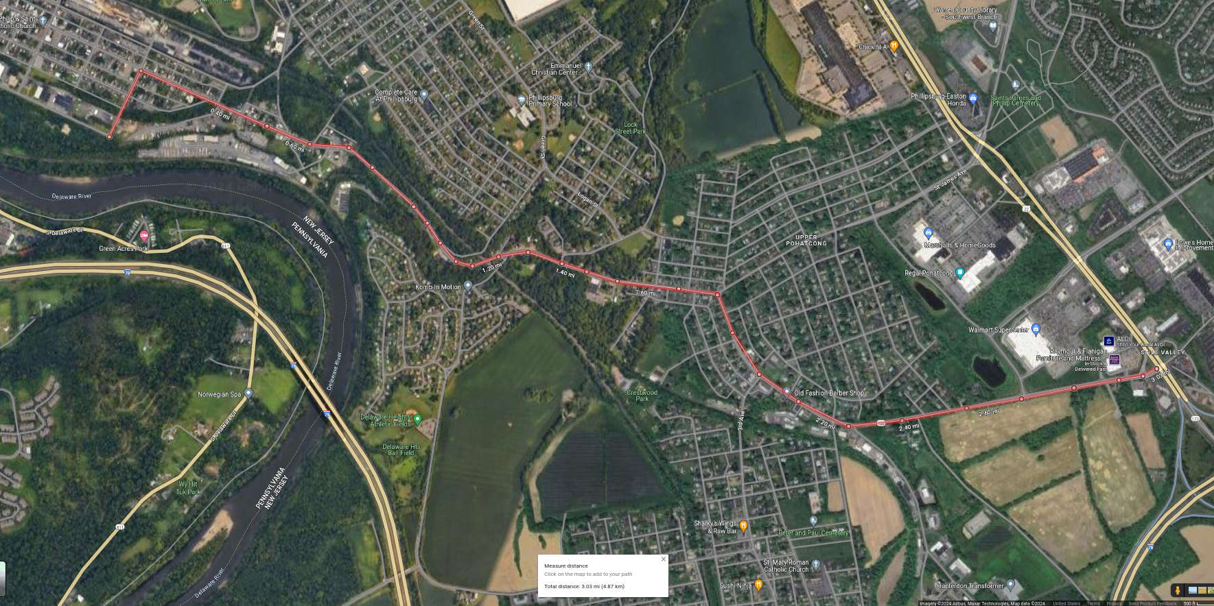
Warehouses over 150,000 square feet should be close to major highway networks. The Peron Howard Street warehouse, if legal truck routes are used, will travel over three miles and through several residental neighborhoods.
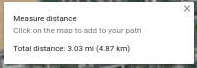 As per the September 7, 2022 New Jersey State Planning Commission - Warehouse Siting Guidelines, warehouses over 150,000 square feet shuould be next to major highway networks. The Google Map below shows the only legal truck route (marked in red) for trucks to use to navigate to a major highway. The only legal truck route will be over three miles and travel through several residental neighborhoods in both Phillipsburg and Pohatcong, New Jersey. This again shows that the Peron Howard Street property is a very bad place to build a warehouse between 320,000 and 420,000 square feet.
Because of the extremely long route to get to a major highway, it most likely can be expected that tractor trailers will use the downtown weight restricted South Main Street corridor if they wish to travel on route 22 west. Another weight restricted roads that trucks currently use are Center Street in Phillipsburg and Saint James Avenue in Pohatcong. We expect that trucks from the potential Peron Howard Street warehouse will increase their illegal use of these roads as shortcuts in order to shave time and distance off their routes.